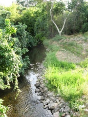
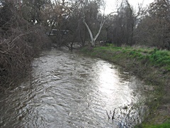
Big Chico Creek is the most popular stream in Chico because it passes through its heart and is rarely dry. In fact, for much of the summer it fills Sycamore Pool at One Mile for enjoyment by countless families. Swimmers can also be found all along its banks in Bidwell Park, though many prefer a day's outing at one of the many deeper swimming holes at Upper Bidwell Park. These areas enjoyed by swimmers are within the Riparian ecosystem where vegetation such as pipevine and valley oaks thrive. Many animals depend on these ecosystems, thus proper management of the creek is incredibly important.
The creek is an important gateway to spawning waters for Chinook Salmon.
The headwaters of Big Chico Creek is around Colby Mountain. Its watershed is formally known as the Big Chico Creek Watershed and it covers an area of about 327 square miles.1 Like most watersheds in California, it follows a dendritic pattern. The creek is controlled so the potential for flooding is low, although this means that sedimentation is problematic. Sometimes portions of trails in Bidwell Park will flood-out, such as on February 23, 2009. In 2006, the Bidwell Bowl Amphitheater flooded.
Big Chico Creek empties into the Sacramento River at Sandy Gulch. For maps of this watershed, see Chico State's Big Chico Creek Watershed Alliance Mapping page.
Many of Chico's streets drain into the creek, so don't dispose of polluting substances down storm drains!
History
2007
In Fall of 2007, a group consisting of volunteers, California's Department of Water Resources, Butte County, and Streaminders organization, completed a project which created a small floodplain just downstream from the Nord bridge. The creek had been downcutting too much, causing over steepened slopes and thus serious erosion. If this process were allowed to continue, Bidwell Avenue would have been seriously threatened. The floodplain, complete with erosion preventing plants, should slow the creek down during the wet season and prevent damage to surrounding property.  Artificial floodplain just off Nord during the Summer.
  The creek and the artificial floodplain just after a storm on Feb 23 2009.
Footnotes
1. Hydrology Map, http://www.gic.csuchico.edu/projects/watersheds/chico/index.html


