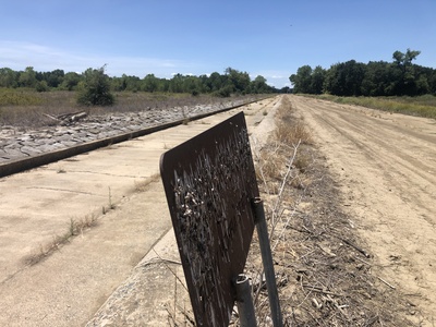
 Standing on the crest of the WeirFremont Weir is the fourth of six weirs (as observed heading downstream) in the Sacramento River Flood Control Project. Fremont Weir was completed in 1924. It is the first overflow structure on the river's right bank when heading downstream, and its two-mile overall length marks the beginning of the Yolo Bypass. It is located about 15 miles northwest of Sacramento and eight miles northeast of Woodland. South of this latitude the Yolo Bypass conveys 80 percent of the system’s floodwaters through Yolo and Solano Counties until it connects to the Sacramento River a few miles upstream of Rio Vista. The weir’s primary purpose is to release overflow waters of the Sacramento River, Sutter Bypass, and the Feather River into the Yolo Bypass. The crest elevation is 33.50 feet and the project design capacity of the weir is 343,000 CFS.
The Fremont Weir marks the northern boundary of the Fremont Weir State Wildlife Area, a 1,461-acre riparian area open to the public for recreation.
Around 8:00 AM on March 12, 2016, water began flowing over the Fremont Weir into Yolo Bypass for the first time in over three years (since December 2012).
At approximately 1:30 AM on January 9, 2017, water began spilling over the weir into the Yolo Bypass.


