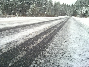
 Highway 50 after a late spring snowfall
Also known as Route 50 or US 50, Highway 50 ran the proverbial coast to coast. It has sometimes been called "The Loneliest Road in America" (for the Nevada portion) and "America's Backbone".
Highway 50 is a US highway, a designation that predates the interstate system by many years. It formerly began in either San Francisco or Oakland, and came through Davis. Subsequently, the area west of West Sacramento was chopped off as redundant with I-80, I-580 and other roads. Now, the beginning is at the I-80 / Business 80 split in West Sacramento. It shares a designation for 5 miles with Bus-80, and then splits off to Carson City, Nevada and through the Midwest and all the way to Ocean City, MD. Route 50 goes through the following states:
- Nevada
- Utah
- Colorado
- Kansas
- Missouri
- Illinois
- Indiana
- Ohio
- West Virginia
- Virginia
- Washington D.C.
- and finally Maryland
On the Davis Wiki's I-80 page, you can see a sign showing the distance to Ocean City, MD. On route50.com, you can see the sign at the other end of Highway 50, showing the distance back to Sacramento, CA.
Usefulness for Davisites
There are many popular Adventures that await you outside of Davis, many of which can be accessed via Highway 50. South Lake Tahoe is a popular summer time and winter time destination. Multiple Ski Resorts can be accessed along Highway 50, the closest of which is Sierra At Tahoe. Summer time brings wonderful hiking in many areas of the Sierra Nevada, including the Desolation Wilderness and the Pacific Crest Trail.
Information Sources
Conditions: http://www.dot.ca.gov/hq/roadinfo/us50
Broken link to something: http://www.dot.ca.gov/hq/traffops/signtech/calnexus/reports/fiftyeast.htm


