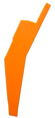
This page is part of the Plasticspace Project.
Census block 260810111023030
Description
This space is a long and narrow area between US 131 and the Grand River. It includes the sports complex that houses 5th/3rd Ballpark, home of the West Michigan Whitecaps. It also includes the Boathouse of the Grand Rapids Rowing Club. The space may include the former site of the North Park Fair Grounds. Just south of the southern tip of the shape appears to be the location of the now defunct Grand Rapids Speedrome. The approximate location of the former Speedrome is indicated on the lower portion of the map below in a light blue color. At the Northern end of the space there are residences along the Grand River.
Shape Associations
- splint
- crickett bat,
- “we’re #1” foam hand sign used at sporting events
- canoe paddle
- state of Nevada
- arm-elbow
Map
Bodies of Water
- Grand River
- Wetlands
Material Notes
- dirt and sod plugs
- various gravels from the baseball field
- pile of old tires
- gravel supply companies
- landscaping supply company in the vicinity with various rocks, ground covers, and materials
- nearby concrete recycling center
Disrupted and Dead-end Streets
- Lovers Lane
- Ball Park Drive
- Abrigator Trail
- West River Center Drive


