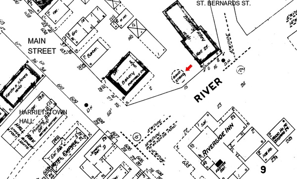
 1908 Sanborn map Address: Gas station parking lot on River Street at corner of Main Street
Old Address: River Street
Year built: By 1903; gone by 1924.
The River Street Bandstand appears as a circular footprint on the Sanborn maps of 1903, 1908 and 1916. It was mentioned in this excerpt from The Spaulding Block, a focal point of village life, by John J. Duquette from the Adirondack Daily Enterprise, December 12, 1992: "At the rear was the village bandstand and the community bowling alleys . . . "; and "Presently the Sugar Creek convenience store and gas station has acquired the Spaulding site, while the Riverside Inn has given way to a village park which, by the way, features a bandstand directly across River Street from where an earlier bandstand stood 85 years ago."
One or the other of the wide spots in the intersections of River Street with St. Bernard Street or Main Street (well illustrated here on the Sanborn map) was known for a time in the past as Riverside Square, according to the inscription on a photograph in the Adirondack Collection, Saranac Lake Free Library. The photo appears on the page for Winter Carnival, 1898 through 1920.


