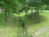
 Above St Cross, photo by Annette in May 2009 Sow Brook (North) runs through the grounds of Hospital of St Cross
It then travels under Barby Road through to Dunchurch Road between Beaconsfield Avenue and Southbrook Road.
 Near Barby Road, photo by Annette in May 2009 Near Barby Road, photo by Annette in May 2009 |
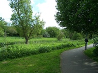 Between Dunchurch Road and Barby Road, photo by Annette in May 2009 Between Dunchurch Road and Barby Road, photo by Annette in May 2009 |
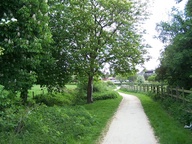 photo by Annette in May 2009 photo by Annette in May 2009 |
 photo by Annette in May 2009 photo by Annette in May 2009 |
 photo by Annette in November 2007 photo by Annette in November 2007 |
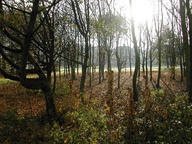 Photo by Annette in November 2007 Photo by Annette in November 2007 |
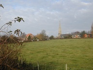 St Marie's Church, from the bridge over the brook. Photo by Annette in November 2007 St Marie's Church, from the bridge over the brook. Photo by Annette in November 2007 |
 Between Bilton Road and Dunchurch Road, photo by Annette in May 2009
 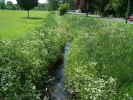 Between Bilton Road and Dunchurch Road, photo by Annette in May 2009 The brook then runs underneath Dunchurch Road emerging to run roughly parallel to Hibbert Close and Wentworth Road, alongside a large open grassed area.
Sow Brook (North) reaches Bilton Road at the Buchanan Road/Bilton Road/Stourhead Road crossroads. Crossing diagonally through a viaduct beneath the junction, it then runs alongside Bilton Road and is joined by Sow Brook (South) before it turns to run along the back of May Lane.
Sow Brook (South) runs between Deepmore Road and Lytham Road, continuing towards Bilton Road to join Sow Brook (North). Where does it come from before this?
The brook crosses Addison Road and runs North West through another open grassed area before turning North to run underneath the disused railway line. 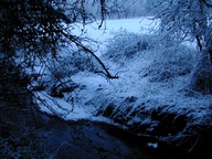 Behind Somers Road, photo by Annette in 2006
 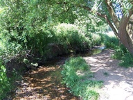 Near Frobisher Road, photo by Annette in May 2009
 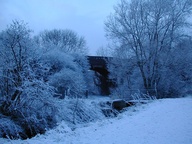 Under the old railway bridge, photo by Annette
The brook continues North through the Rugby Cement Works site before passing under the main rail line and joining the River Avon


