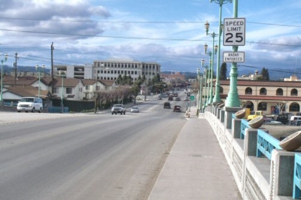
 Main Street in Watsonville from the bridge over the Pajaro River. Photo: 2/20/2010
1. In Watsonville, Main Street starts at the bridge across the Pajaro River on the southeast border of town. (Across the bridge in Pajaro, it is Porter Drive.) It continues through Watsonville in a northwest direction. At the Freedom Boulevard junction, Main Street goes more west than northwest. Main Street continues to Holm Road where it officially becomes the on-ramp to Highway 1 northbound. Main Street in Watsonville becomes part of Highway 152 at East Beach Street and continues to the end of Main Steet (Highway 1).
With the construction of the shopping areas west of Ramsey Park, many locals refer to the area as "New Main" and the area of downtown as "Old Main."
For most streets of Watsonville with East/West in the name, Main Street is often the dividing line for the change. (Example: East/West Beach Streets.)
2. In Soquel, California, South and North Main Street are both considered "Main Street" by the County. The street signs say "MAIN STREET." It is only North Main Street and South Main Street on maps and street addresses. Addresses start at 2505 South Main Street and continue in sequence through North Main Street. North Main Street starts at Soquel Drive and continues for about one mile to a fork in the road. Left (northwest) is Cherryvale Avenue, right (northeast) is Glen Haven Road. There is no confusion if an address is without a North/South identifier.
3. In Ben Lomond, Main Street runs north from Mills Street to Sunnyside Avenue and continues for about 120 yards afterwards.
4. In Santa Cruz, Main Street runs north from Beach Street to 3rd Street.
History
The connection between Main Street in Watsonville to the town of Pajaro was once a ferry crossing. In 1868 John Heerandner (he was called, "Dutch John") built a toll bridge at that location. It opened on Thanksgiving day and three weeks later was ruined by a flood. He re-built the bridge doing much of the work himself. A few months later, the counties of Monterey and Santa Cruz purchased the bridge and eliminated the toll.
Businesses
1. Several shopping centers are on Main Street in Watsonville. 2. North/South Main Street in Soquel has a few businesses and is other-wise residential. Michael's On Main is on South Main Street in Soquel.
Transportation
1. Most bus routes in Watsonville travel part of Main Street. (The major bus center is one block away.) Bus routes 71, and 69W as two examples. 2. There are no bus routes that travel North/South Main Street in Soquel. Several bus routes cross Main Street intersection at Soquel Drive. 3. No bus routes that travel Main Street in Ben Lomond. Route 33 crosses Main Street at Highway 9. 4. No bus routes that travel Main Street in Santa Cruz. Route 7 crosses Main Street at Second Street.
Maps
Main Steet in Watsonville can be found on the following USGS maps.
| Sequence | Latitude(DEC) | Longitude(DEC) | Latitude(DMS) | Longitude(DMS) | Map Name |
| 1 | 36.8749540 | -121.7963406 | 365230N | 1214747W | Watsonville West |
| 2 | 36.9052312 | -121.7507832 | 365419N | 1214503W | Watsonville East |
:MSN map of South/North Main Street in Soquel
:MSN map of Main Street in Ben Lomond.
:MSN map of Main Street in Santa Cruz.
 |
This entry is a seed - a starting point for writing a full entry. You can help the Santa Cruz Wiki by expanding it! Simply click on the "Edit" button. |


