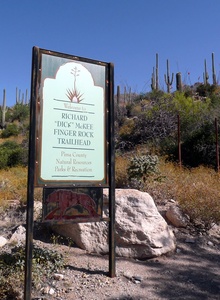
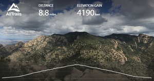
Finger rock trail is a 8.8 mile moderate hike in the foothills of Tucson, Arizona managed by the Santa Catalina Ranger District
Contact information:
Phone: (520)749-8700
This hike takes an average of 6-8 hours to complete. Your adventure will be complete with breathtaking views, wildlife sightings, and an abundance of desert foliage. Bring at least 3 liters of water for person; The average temperature in the summer is around 105 degrees. This suggestion should not be taken lightly. There have been several heat stroke related deaths on this trial so make sure that you are well equipped and if you feel fatigued turn around and head back.
Warnings:
There have been several incidences of hikers suffering from heat exhaustion when on this trail. If you were from Arizona, you might most likely know how quickly the heat can sneak up on you and that taking the proper precautions is imperative to your health. That being said, if you’re visiting from somewhere it is important to note that there have been deaths related to heat on this trail. “As temperatures began cresting above 115 degrees in the mountains, the heat drained the hikers and their strength so insidiously that only one could walk to summon help. The others lay helpless, baking on the trail.” This is an excerpt of the experience that these men endured. Sadly, only one of them made it out of the mountain range alive. This hike is beautiful and a great way of getting in touch with Sonoran wildlife, but please make sure to come prepaired.
It is advised that you bring:
-Sunscreen
-3 liters of water per person
-closed toed shoes
-some form of protection from the heat ie hats/sunglasses
-first aid kit
What you can expect to see:
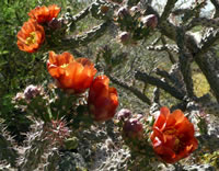
During your hike, you can expect to see you saguaro cacti, ocotillos, chollas, prickly pears, paloverde, brittlebush, jojoba, and other desert plant life. Hikers have seen javalina, coyotes, mountain lions, and many other species of wildlife. When the hike starts, you will be surrounded by saguaros and creosote plants. As you ascend into the Upper Sonoran Zone of the mountain the foliage will change and the presence of yucca, oak, juniper and agave will be become more notable. If you are planning on reaching this point of the hike it is it buys that you don’t bring pets due to the presence Desert Bighorn Sheep. As would be expected, the scenery and views become more breathtaking over the course of your ascension of the mountain.
Hiking details:
The finger rock trail hike climbs from 3,100 feet in elevation to 6,200 feet. It is eatimated to be 9 miles and take between 6 and 8 hours to complete.
Directions:
Drive north from Tucson on the Oracle Road (US 89) to Ina Road. Turn right (east) on Ina and drive about a mile to Skyline Road which branches off to the south (right). Follow Skyline (have to make a left to stay on Skyline) to Alvernon Way and turn left (north) to the trailhead and parking lot at the end of the pavement. Look for the sign that says ‘Finger Rock Estates’ and find the closest parking area. Parking is limited so make sure to keep that in consideration during busy seasons.
Resources:
https://www.fs.usda.gov/recarea/coronado/recarea/?recid=25644
https://www.fs.usda.gov/recarea/coronado/recarea/?recid=25644
https://www.google.com/amp/s/www.washingtonpost.com/news/morning-mix/wp/2016/06/22/100-percent-avoidable-hiker-deaths-mount-in-blazing-az-heat-wave/%3foutputType=amp


