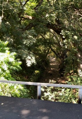
 Browns Creek, summer 2010. Photo by John Pilge.
Browns Creek flows 4.5 miles to Corralitos Creek. Elevation is between 279 to 259 feet above sea level. It is part of the Corralitos Creek watershed. Although an intermittent stream, Browns Creek is on a monitoring schedule for water quality. The downstream connections affect the water supply of Watsonville and the fish.
Community Browns Creek is within one mile of the town of Corralitos. There is a Grange chapter (#837) called the Browns Creek Grange in the area.
History Named for Isiah Brown who settled in the area in 1862. A valley in the area is also named for him. Other names for the creek have been Brown Creek and East Branch Corralitos Creek.
Maps
Browns Creek is found on USGS maps:
| Sequence | Latitude(DEC) | Longitude(DEC) | Latitude(DMS) | Longitude(DMS) | Map Name |
| 1 | 36.9952285 | -121.8021749 | 365943N | 1214808W | Watsonville West |
| 2 | 37.0363384 | -121.8032858 | 370211N | 1214812W | Loma Prieta |
 |
This entry is a seed - a starting point for writing a full entry. You can help the Santa Cruz Wiki by expanding it! Simply click on the "Edit" button. |


