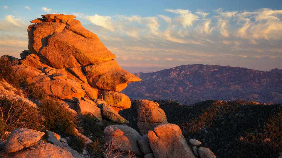
The Catalina Highway is a stretch of road that runs from the base of the famous Mount Lemmon, winding all the way up to the top of the mountain, before stopping at the summit, near the town of Summerhaven. The road is famous for the sheer diversity of land and biomes as you drive down it, as the climate changes drastically by the time that you reach the top. In the almost 7000 feet that are climbed in the process of a drive up the mountain, one will drive through many forests with towering trees and deserts covered with saguaro cactus. The highway winds all the way up to the top of the mountain, with various stops and diversions along the way, allowing tourists and hikers easy access to different trails and scenic overviews from anywhere they would like. These stops also include a number of lakes and camping sites, and the highway provides an easy way to get there for anyone who is interested. There are also almost always bikers and runners using the side of the highways to travel up the mountain. It includes many shoulders and rest stops for people using the highway as a way to get a workout in. While the road climbs all the way up to the top of Summerhaven, it stops right before you can reach the 9,100 foot absolute top of the mountain. Once reaching the top, and summerhaven, travelers will have an excellent view of the Santa Catalina mountain range. By the time a traveler reaches the top of the mountain, the temperature can drop as low as 40 degrees lower than it was at the base of the mountain. This can lead many people to come stay in Summerhaven during the summer, when the ground level of Tucson is just too hot for some people to stay at consistently
History
The history of the Catalina Highways begins in 1933, when the people of Tucson and Summerhaven determined that access to the mountain should be much more easy and efficient, and a new initiative to build a central road up the mountain began. The first part of this was to establish a small federal prison at the base of the mountain, whereby the prisoners there would provide labor towards the construction of the highway, as part of their sentence. Due to the sometimes very hot weather at the base of the mountain, construction was arduous and difficult. At the beginning of the second world war, the federal prison camp at the base of the mountain was converted to an internment camp, and renamed the Catalina honor camp. The government still continued the practice of using the camp for the supply of labor on the highway. The work on the road finished in 1950 and was applauded by the residents of both Tucson and Summerhaven a s a really wonderful success. Despite not being the most masterfully built road, it was the first direct access between the two areas, and it streamlined everything from mail delivery to firefighting. It drastically improved the lives and living situations of people in Summerhaven and still continues its' usefulness today. On any given drive up the mountain, travelers can see all sorts of mail trucks and delivery trucks driving upwards on the mountain. This exemplifies the reasons for its' construction and serves as a stark reminder of the hard work it took to provide this luxury to the people of both areas.
Initially following construction, the road was extremely narrow and deemed fairly unsafe for use. Over the years, there have been multiple funding initiatives and work done so that the road is in the safe, well kept condition it is today. In the later part of 2007 a final construction project finished that put the road in the final state it is today. It now has multiple shoulders and stops along the highway to provide a safe and beautiful trip up the mountain. In the mid 1990's there was some controversy relating to the use of forced labor in the initial construction of the road. As an apology for the use of internment camp labor to produce the initial highway, one of the main campsites on the highway is known as the Gordon Hibayashi campsite, named after a man who worked while being interred. It is a beautiful area of the trail dedicated to horseback riding and recreational camping.

Use Today
The Catalina Highway provides a lot of use to the people who help keep the mountain safe. Just recently in 2018, there was a new construction of a waterline to help firefighters on the mountain combat the ever present threat of wildfires in the area. this waterline runs along and in conjunction with the highway itself, and uses water from the mountain to provide constant and full water storage. The road also provides a quick and accessible way for firefighters to get to the fires they need to put out in a fast and efficient manner. It also helps the supply of goods and items in a useful and timely way. The University of Arizona also uses much of Mount Lemmon to engage in educational and research driven trips, which would not be possible without the use of the Catalina Highway. It helps students use the entirety of the mountain for both recreational and educational purposes. The University of Arizona even has an interactive electronic tour that the students can go on using their phones. It involves going up the mountain while playing the tour, and clicking on the areas that you are in to give further detail and analysis on the surrounding area. Oftentimes new students will go on this tour with the help of the University, allowing them to gain a better sense of the beauty of the Mountain, and to gain a deeper respect for the diverse and beautiful aspects of the nature within. Mount Lemmon and the Catalina Highway will continue to be a great resource for the university for years to come. Without the Highway itself, there would be no easy access to these areas, and for that it is vitally important.
Sources
Catalina Highway | Arizona Highways
Catalina Highway | AZGS Document Repository
Coronado National Forest - Catalina Highway Scenic Drive (usda.gov)
Sky Island Scenic Byway | Explore Arizona (myscenicdrives.com)

