An Bán Íseal or Bawnishal is a townland of 156 hectares or 384 acres and in the early part of the 20th century, 169 individual fields were mapped in this townland.
It is in the Electoral Division of Castlehaven South, in Civil Parish of Castlehaven and the Roman Catholic Parish of Castlehaven and Myross.
An Bán Iseal is bordered by Ard Gaotháin (Ardgehane) and Barraí Rua (Barryroe) to the west, Blúid Thiar (Bluid West) and An Leathardán Mór (Laherdane More) to the north, An Chrois Liath (Crosslea) and Leic Eoghain (Lickowen) to the south and An Dúinín (Dooneen) to the east
OpenStreetmap contributors, with input from the Castlehaven & Myross History Society, have created a detailed townland map including all its minor placenames. Zoom in for further detail.
Etymology
Bán Íseal was intepreted by Bruno O'Donoghue as the low plain. In his article in Volume 7 of the Skibbereen and District Historical Society Journal, Eugene Daly interprets it as a low pasture field. J.M. Burke also interprets it as a low-lying field or pasture in his Southern Star article in 1913. He points out that it is important to distinguish between a bán (lea-ground / pasture land) and a badhún which is an enclosure attached to a farmhouse and was often known as a "bawn". Badhún is thought to come from bó-dhún (cow fort). It should be noted that there was a cattle pound at the lowest part of Bawnishal which was used for holding cattle that were confiscated from farmers who defaulted on their tithes. It should also be noted that we know that the townland was called Bawneishal in 1656 (Down Survey) which was before the Tithe Wars.
Ironically Bawnishal probably has the highest road location in Castlehaven or Myross at Bealach (pass/route/way). It is interesting to note that this townland tends always to be spelt locally as Bawnishal while the official name is Bawnishall (double "l") There is only one townland that is officially called Bawnishal in the country and that is just a few miles away in Caheragh which is just north of Skibbereen! That name is also derived from An Bán Íseal.
History
Bawnishall Creamery: In his article in Volume 1 of the History Journal, Jerome Geaney describes how an illegal creamery which was known as The People's Dairy was opened at Bawnishal Cross by members of the former Dooneen Creamery which closed in 1928. They felt that this was their only option as most had three cows or less and some were also fishermen so Raheen was too far away. There was a court case in July 1930 when the Minster of Agriculture prosecuted forty local farmers for running an illegal creamery (part of the wall can still be seen at the south east corner of the crossroads). The argument of the farmers was that their other option was to bring the milk to the creamery in Rineen but that was up to six miles away "over one of the worst roads in Ireland". They stated that they were separating the milk at this creamery for their own use and no milk or butter was on sale here. Also there was no co-mingling of milk on the premises. The butter that was made was sold to a Mr. Shanahan, who was a butter exporter from Cork, and cheques were issued to the farmers The inspector for the Department denied that the creamery was "clean and well-run". The case was adjourned for eight weeks to allow talks between the local farmers and the Drinagh Co-Operative. The defendants were as follows:
Lawrence Daly, Lickowen, Patrick Coghlan, Yokane, John Murphy, Scobane, Jerh. McCarthy, Lahara, Wm. Driscoll, Castlehaven, Jerh. Sheehy, Bawnishal, Denis Collins, Scobawn, Jerh. Connolly, Ardgehane, Ml. Maguire, Gortnacrossig, Patrick O'Donovan, Bawnishal, James Attridge, Lickowen, Wm. Savage ,Bawnishal, Peter Barnett, Doneen, Patrick Regan, Lickowen, Denis Driscoll, Yokane, Mr. Keohane, Lickowen, John Mahony, Toehead, Patrick Hallihane, Toehead, Patrick Keohane, Lickowen, Michael Hallihane, Toehead, John Sexton, Doneen , John Collins, Scobawn, Patrick Keohane, Toehead, Henry O'Leary, Crosslea, John Sullivan, Scobawn, Pat Sheehy, Toehead , M. Driscoll, Barryroe, Timothy Sexton, Scobawn, John Cronin, Toehead, Jas. Donovan, Gortnacrossig, M. Connolly, Bawnishal, Con Sexton, Scobawn, Tim Murphy, Yokane, John Hurley, Gortnacrossig, Rd. Daly, Toehead, Ml, Leary, Ballycahane, John Twomey, Scobawn; Jerh. Donovan, Gortnacrossig, Jerh. Driscoll (Cadogan), Bawnishal, M, Keohane, Lickowen, Jerh. Collins, Ardgehane.
Dance Platform: The formation of the modern Castlehaven GAA club is described in Marching To Glory by Bernard O'Callaghan. It descibes how there was a dispute about the playing of a melodian at the dancing pattern at Annie Cadogan's house at Bawnishal Cross. As a result, the melodian was kicked to pieces and one of the residents of this townland was dispatched to buy a football. Who knows how the course of football history might have changed if that row had not happened. It is perhaps fortunate that he did not have the price of a set of hurleys!
Cillín: A cillín is a graveyard used fo the burial of unbaptised infants was similar in most rural parishes. There is a story that one in Bawnishal was discovered when ploughing but the remains were promptly buried and the fields left untilled indefinitely. Perhaps what was more traumatic was the fact that the child was to remain nameless and the location a secret, kept from the grieving mother. The burial usually took place at night. ******
Housing
As part of Griffiths Valuation in 1853, a survey of house quality was carried out to calculate what rates were due by each household. These were issued in 1850 in the form of house books (Pg 1, Pg 2, Pg 3) and a guide on how to interpret these can be seen here. These show that 27 of the 30 houses in the townland at the time were class 3. This means that they were all thatched houses with stone walls with mud or puddle mortar (as opposed to houses built with stone or brick and lime mortar). Within class 3 there are a number of different categories. 23 of these houses are old (more than 25 years old) with eleven being in repair, 11 out of repair and 1 delapidated. The other four class 3 houses are of medium age (one is slightly decayed but in good repair while the other three are deteriorated by age and not in perfect repair).Three houses in Bawnishal at this time are class 1 which means that they were slated and built with stone or brick and lime mortar - one is slightly decayed but in good repair while the other two are deteriorated by age and not in perfect repair. All houses in the townland at this time are between 5 foot (!) and 9 foot tall which indicates that they are single storey at this time.
By the 1901 census (Pg 1, Pg 2), there are 19 occupied houses in this townland at this time and all have walls of stone, brick or concrete. Ten still have thatched roofs while the other nine have roofs of slate, iron or tiles. All houses, bar one, have two, three or four rooms while the other just has one room. Thirteen houses have just two windows in front which indicate that they are probably still single storey at this time. The other houses have either three,four or five windows
When we advance to the 1911 census (Pg 1, Pg 2) there are still 19 occupied houses in this townland and, not surprisingly, all still have walls of stone, brick or concrete. . Nine are still thatched while the other ten have roofs of slate, iron or tiles. 14 houses have two, three or four rooms while one just has one room. The other four houses have either five or six rooms. Ten houses have just two windows in front at this time. One house is listed as having no windows at the front while four have three windows and another four have five windows.
Places of Interest
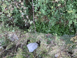
Copper Mines: There are two disused copper mines in Bawnishal – one at the north end and one at the south. These were worked in the 18th and 19th centuries. It is believed that work may have stopped when the mine captain (Thomas Kitto from Cornwall) died in 1863 at the age of 65. He is buried in the graveyard of the church in Castletownshend village.
 Gunpowder store at north mine from a distance
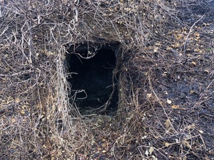 Gunpowder store entrance at north mine
 Gunpowder store interior at north mine
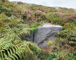
Killcloonagh Burial Ground: This is located at the western side of the townland. The name is believed to translate from Cill Cluanach (the burial place of the lawn or meadow) or possibly Cill Cluain Eich (Church of the Steed’s (Horse’s) Meadow). A papal document in 1199 mentioned a parish called Cluainechi between Glenbarrahane (Castlehaven) and Aughadown. It may possibly be here. There is a good example of a mass rock also at this location. Mass was said here in penal times when it was banned
Lios: There is a ringfort (lios) in this townland . A ringfort is a circular fortified settlement that were mainly built during the Bronze age up to about the year 1000. Stones were removed in the past but it was said that this was one of the finest examples of a ring-fort in the area and rivalled the one aat Knockdrum.
Tobar Na Súl: There is a holy well in this townland with this name. It can be interpreted as the Well Of The Eyes and was used by people that had eye diseases. It is also said that it was frequented by people with headaches at the weekend and feverish people might also drink here
Tobar Dhá Chat: There is another holy well in this townland and can be interpreted as the Well Of The Two Cats. According to Lankford, it was frequented mostly for headaches on Saturday and Sundays. Feverish people would also drink here. According to the Historic Environment Viewer, the two holy wells are 70m apart. It also states that this well was shown only on the O.S. map of 1842.
Bawnishal Cross: This is the crossroads at the bottom of the townland and has roads that lead towards Toe Head, Castletownshend and Tragumna.
Pattern: There was a dancing platform in this townland at one time. This was a place where locals would meet up and dance on a Sunday afternoon in the first half of the 20th century. The name of this event was a pattern. Relations would sometimes sour between Pro and Anti Treaty supporters after the Civil War.The one in this townland was located at Cadogans house (and shop) at Bawnishal Cross. This was the house where Winnie (from Mrs Brown's Boys) later lived.
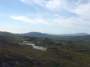
Cnoc na nGabhar: This can be interpreted as the Hill Of The Goats and it is said that wild goats lived here in the past. The highest point in Castlehaven or Myross parish is on this hill (156m). There is a wedge tomb on this hill (known locally as the Giant’s Grave) and also a lake (The Giant’s Lake). The lake is in Bawnishal townland. Apparently local people grew flax in the 1940’s and ‘soaked it in the lake’. However when they took it to the mill it was rejected as there was spring water in the lake. At the time you had to soak it in water for 16 days before drying. It was described as smelling worse than slurry.
The Historic Environment Viewer lists the two holy wells, the lios and the burial ground mentioned above. In addition it lists an earthworks at the northern end of the townland on the border with Bluid West
Interesting Placenames
Besides those mentioned above, placenames of interest are Bealach (the way/route - highest point in townland). Barr na gCabhlach (peak of the ruins?), Carraigín na Súl (rock with a view). There is also a point in the stream at the south end of the townland known as the Fall Down.
There is a field named Clais a' Spúinc can be interpreted as the field of coltsfoot. Apparently this was grown here and was smoked during the war as a tobacco substitute. Near Bawnishal Cross, we find the Pound Garden.This refers to a Pound or Póna which take us back to the 18th and 19th centuries when the Church of Ireland were controversially entitled to a tithe and animals would be taken from the (mainly Catholic) defaulters and held in these pounds. A field called The Mines in the northern half of the townland points to a time in the middle part of the 19th century when there were two separate copper mines in Bawnishal.. Another field is called the Holy Ground which apparently got its name after a priest that came out to help the locals to plough a field during the landlord times.
Some of the roads running through or along this townland are known as Salter's Boreen, Boóthar Dúinín (Doneen little road) and the coast road.
Other old field names in this townland have been captured as follows: Páirc a’ Phoirt (soft boggy field), The Croc (possibly from currach – a boggy place), The Muilí (possibly from mullach -a summit), An Páircín (the small field), An Chathair (the stone fort), An Cáidín (unknown), The Meadow, Cluainín (small meadow), Cluaisín (possibly a narrow strip), Léim an Uisce (The rising of the water), Páirc a’ Tobair (the field of the well), Páirc a’ Tí (the field at the house), Clais Eacra (a narrow one-acre field), The Bun (bottom field), Clais Dine (unknown), The Orchard, The Haggard, The Potato Field, The Clover Field, An Bán Mór (the big pasture), An Bán Beag (small pasture), Sléibhín (field with a small hill), Móinteán (a boggy place), Móinteán Hic (not known what Hic refers to), The Lár (a middle field), Páirc Méith (a fertile field), Páircin na Farraige (the sea field), The Western Field, the Middle Field, The Bog Field, Gortín Artur (Arthur's little field), The Clais (the field), The Long Clais, An Clais Mór (the big field), The Mountain, Glanworth, The Mullach (peak/summit), Clais Fada (long field), Páirc Grafa (a grubbed field), Séasúr an Iarthar (unknown), Cabhlachín (little ruin), Cúl na gCloch (stony back field), Móinteán Liath (a grey boggy place), The Grafín (little grubbed field), Gort Uí hÉin (unknown - might be linked to birds or a name), Páirc Fauchlann (unknown), Páirc Locthtra /Lochta (unknown - lochta is a loft), Páirc Selanes (unknown), Pís na Tuaithe (unknown), Báinseachs (an anglicisation of Na Báinsigh - greens, lawns), Páirc Conchubhair (Conor’s field), The Cúl (a back field), Cremins (unknown), An Leaca (sloping field), Gort a’ Bhealaigh (field of the way/route), Láithreach (damp area), Tuar Beag (small paddock), An Chuilín (small back field), Clais na nÓg (possibly the field of the young), Páirc Lár(the middle field), Currach Fhionnáin (soft field with boggy grass), Cúl na hAdhairce (field of the horn), Clais na Cille (field of the graveyard).
If you want to see the actual locations of any of these, go to detailed townland map on Open Street Maps. If you know any other field names or placenames in this townland (or if you need to correct any or give further background information), please contact us at [email protected]
Folklore
Ghost on the Hill: The following short story was included in the Dooneen Schools Collection - it was written by Bean Ní Laoghaire (Mrs O'Leary) of Bawnishal.
Long ago there was a man called Tadhg McCarthy that lived in Bawnishal. One night he placed a bundle of hay on the hill above his house. When the neighbours that lived near him came out that night, they saw the hay on the hill and because the moon was shining they thought it was a ghost that was standing there. They were afraid and called all the neighbours that lived around them. They gathered pikes and sticks and ran towards the ghost to kill him. The men did not panic. Tadhg himself had forgotten that he had put the hay there and he himself wanted to kill the ghost. They spent a large part of the night there. When the morning arose, they saw the bundle of hay and were laughing at themselves.
There is a note in the Dooneen school's collection that Mrs O'Leary (Bean Ní Laoghaire) was a farmer's wife. There is also a note that they did not think that her daughter told the story correctly.
War of Independence: When a farmer in Upper Bawnishal was removing a ditch between two fields some years ago he found an underground hiding place covered by some sheets of metal. It is believed that this was used to avoid the Black And Tans during the War of Independence
The March to Bawneshall: The following poem "The March to Bawneshall" (written by Michael Barry of Ballyalla) was published in the Southern Star in March 1925)
Last Sunday from our camp we marched,
Beneath the azure sky,
The gentle breeze was sighing,
The lark sang loud on high.
We lined in martial order,
Beside Tragumna Bay,
Then came the order "Forward",
For Bawneshal far away.
The road was lone and dreary,
But yet our hearts were brave,
We could view the broad Atlantic,
And watch each curling wave.
The sweepers lay at anchor,
Far out across the bay,
And the world seemed filled with gladness,
On that lovely vernal day.
At Tragugh we halted,
Just for a little while,
Our homes lay far behind us,
Yes, many a weary mile.
We viewed Hesperian lifeboats,
Both sad relics of the fray,
And prayed for those who're sleeping,
Near the Fastnet far away.
At length we reached the Footer field,
And played a friendly game,
The Toehead boys were splendid,
All worthy of the name.
The boys from Trag were also good,
They played in brilliant style,
They're worthy sons of Ireland,
Our own sweet Emerald Isle.
The Lahern Tower, with lordly style,
Looked o’er each well-known scene,
The hardy sons of Munster,
They’re marshalled on the green,
And Doneen school lay in front,
Where scholars come and go,
And Tralagough’s fair shelving strand,
Outrivaled Tranamo.
When shades of eve were falling,
Our thoughts soon turned to home,
Across the bay and mountain,
Where cattle love to roam.
We came by Devil’s Valley,
Then round by Fountenoy,
When old Tragumna hove in sight,
It filled our hearts with joy.
Now farewell to lovely Tralagough,
And Lahern tower also,
But hurrah for fair Tragumna,
Where the apple praties grow.
Farewell to old Bawneshal,
The crossroads by the sea,
Long live the men of Munster,
The fearless and the free.
Families and Notable Residents
The Tithe Applotment books of 1825 (where the townland was recorded as Banneshall) list the following family names: Sheehane, Sheehane, Sheehane, Connolly, Keohane, Keohane, Keohane, Sheehane, Keohane, Leary, Cathegane, Collins, Leahy, Baldwin, Foley, Leary, Leary, Carthy, Leary, Sheehane, Keatin.
Griffiths Valuation of 1853 lists the following family names: Sheehy, Leary, Foley, Leary, Sullivan, Burke, Salter, Cadogan, Sweeney, Kohane, Donovan, Kohane, Salter, Foley, Foley, Levis, Levis, Sheehan, Sheehan, Hegarty, Connolly, Murphy, Connolly. Samuel Levis appears to be the landlord.
The Census of Ireland of 1901 lists the following family names: Sheehy, Leary, Leary (with Burke - servant), Leary, Burke, Cadogan, Cadogan, Salter, Salter, Connolly, Foley, Sheehan, Savage, Driscoll, Hegarty, Sheehan (with Foley (mother-in-law)), Keohane, Donovan (with Salter - servant), Keohane.
The Census of Ireland of 1911 (where the townland is spelled Bawnishall) lists the following family names: Sheehan, Savage, Hegarty, Driscoll (with Dwyer (grandson)), Sheehan, Foley, Connolly (with Hourihane (servant)), Donovan (with Hourihane (servant) and Woodward (boarder)), Keohane/Kohane, Keohane, Cadogan, Cadogan, Salter, Salter, O'Leary, O'Leary (with Hourihane (servant) and Burke (servant)), Leary, Sheehy, Connolly
Note: the term 'with' refers to a person or persons of a different family name staying in the house. This may have been an in-law or other relative, a guest, or a farm labourer/housekeeper or domestic servant.
Jerry Sheehy from Bawnishal was a champion bowler in the 1970s. His brother, Jimmy, and his neighbour, Jack O'Leary, were also prominent bowlers.
Demographics and Landholding
| *Occupiers | Population | Change | Link to record | ||
| 1825 | Tithe Applotment | 21 | 155 est. | 1825 | |
| 1841 | Census of Ireland | 40 ( Inc.1 unoccupied) | 227 | ||
| 1851 | Census of Ireland |
26 |
165 | ||
| 1853 | Griffith's Valuation |
29 (Incl. 6 unoccupied) |
190 est | 1853 | |
| 1861 | Census of Ireland | 24 | 140 | ||
| 1871 | Census of Ireland | 24 | 129 | ||
| 1881 | Census of Ireland | 23 (Inc. 1 unoccupied) | 124 | ||
| 1891 | Census of Ireland | 21 | 122 | ||
| 1901 | Census of Ireland | 20 (Inc. 1 unoccupied) | 112 | 1901 | |
| 1911 | Census of Ireland | 19 | 94 | 1911 |
*Occupiers generally equate to households having a house and land but may also include households having houses but no land.
**It is extremely difficult to ascertain the exact number of occupiersin 1853 as there was a considerable number of joint leasing arrangements, lots of sub-letting and quite a number of landless occupiers.
Between 1656 and 1658 the Down Survey mapped all areas of the country to track ownership of land after much had been granted to followers of Cromwell after the war of the 1650's. The most prominent proprietor (titulado) of this townland at that time was Teige Downeinge. This townland was called Bawneishall at that time.
This townland was owned in 1841 by the Cummins sisters. It was held under lease by Lord Bandon and let by him to Thomas Baldwin of Skibbereen. The agent was William Atkins of Clonakilty and it was sub-let to tenants without a lease.
In 1841,the soil was described as half coarse and rocky and half arable, producing light crops of wheat, oats and potatoes.
The Cummins family that formerly owned Bawnishal are interesting. Whilst many proprietors owned more than one townland in Castlehaven or Myross, the Cummins's only owned Bawnishal (they may have owned townlands in tther parishes of course). After the Land Act, farmers were allowed to buy land through the Land Commission. One of the sale agreements for a Bawnishal farm lists the vendors as follows:
- Anne Emily Cummins of Artillery Mansions, Westminster
- Lucia Barnard Cummins, Wolnar, Livonia, Russia, spinster
- Ellen Louisa Cummins of Johannesburg, spinster
- Marianne Cardinal Von Widdern, wife of George Cardinal Von Widdern of Merseberg in the German Empire State
Samuel Levis had been the contact in earlier documentation (Griffiths Valuation etc) so I am not sure how long the Cummins family had owned the land for (did they own it when it was a copper mine)
Research shows that the maiden name of Marianne was Cummins from Lewisham in London. It is alos interesting to note that the Wolnar address of Lucia is now in Latvia. They are an interesting family. Their parents had four boys and four girls and their father, Reverend Henry Irwin Cummins, was the rector at St. Alban's, Wood Street, London and he was President of Sion College which was a stronghold of London Presbyterians. Anne Emily worked at St. Thomas's Hospital in London and is credited with inventing the role of hospital social worker. The husband of Marianne seems to have been a German military historian who wrote on warfare methods (seeing as they sold Bawnishall three years before WW1 he may not have been a very good one!)
It is also interesting to note that Samuel Levis had been the contact in earlier documentation (Griffiths Valuation etc) so we are not sure how long the Cummins family had owned the townland for. Perhaps the purchase had something to do with the fact that the copper mines were located there.
Images
 Threshing in Bawnishal
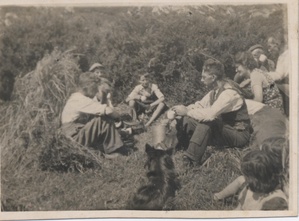 Taking a break in a Bawnishal field
 Preparing for the creamery in 1964
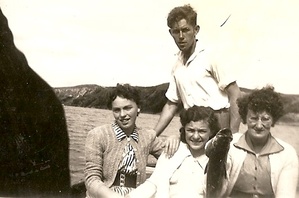 Bawnishal residents on boat at Tráigh Leacach
Further Reading
-
Parish Histories and Placenames of West Cork - Bruno O'Donoghue
-
Placenames Database of Ireland Logainm.ie entry for statutory version in Irish and English
-
A Collection Of Placenames From Cork County, Barony Of West Carbery (East Div.),Volume 2 - Dr Éamon Lankford
- Castlehaven & Myross History Society Journal Vol. 1 - 2020: Miracle Survival of Bawnishal Seaman (Vivian Cahalane) Pg 26
- Castlehaven & Myross History Society Journal Vol. 1 - 2020 Dairying in Castlehaven (Jerome Geaney) Pg 129
- Castlehaven & Myross History Society Journal Vol. 2 - 2021: The March to Bawneshal (Michael Barry Ballyhalla) Pg 46
- Castlehaven & Myross History Society Journal Vol. 2 - 2021: Bawnishal - Part 1 (Adrian O'Leary) Pg 48
- Castlehaven & Myross History Society Journal Vol. 3 - 2022: Bawnishal - Part 2 (Adrian O'Leary) Pg 35
- Skibbereen and District Historical Society Journal Vol. 7 - Placenames Based on the Irish Words for Fields and Land Divisions (Eugene Daly) Pg. 16
- Parish Histories and Place Names of West Cork - Bruno O'Donoghue
- The Metal Mines of West Cork - Diane Hodnett
- Forty Farmers Prosecuted: Important Creamery Act Case - Southern Star, 26th July 1930
- Marching To Glory - A History of Castlehaven GAA by Bernard O'Callaghan - Pg 8
- Dúchas.ie - Schools Collection - An Dúinín - Pg 106 - Scéal Grinn by Bean Ní Laoghaire
- Local Names - JM Burke (J.M.B) - Southern Star - 4th October 1913
- See townlands.ie for information on this townland
Links
Go to Homepage
Go to list of Townlands
Go to list of Irish words used locally
Go to local Flora and Fauna

