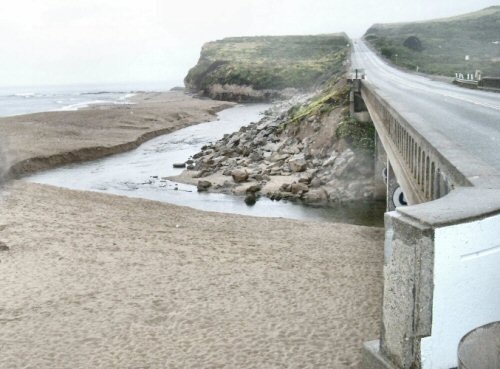
 The cut in the river channel is to help the fish stay alive.
| Location |
| Scott Creek starts in the area of Eagle Rock. It flows southwest for about five miles and then southeast to enter the sea. River mouth is north of Davenport on Highway 1. The water quality of the stream is consistent enough to not require constant monitoring. Scott Creek is part of several water monitoring programs. Scotts Creek encompasses a 39 square mile watershed in northern Santa Cruz County. Scott Creek has several streams feeding into it. Not all have names. Scott Creek is considered a separate watershed with several sub-watersheds by the county. The county calls it the "Scotts Creek Watershed." |
| Historical Info |
| Named for Hiram Scott who bought land in the area. (Scotts Valley —where he lived— is named for his family. |
 This sign on Swanton Road shows the name incorrectly as "Scotts Creek." Click on image for larger view.
Bus route 40 makes a morning stop and a late afternoon stop at Scott Creek. There are no facilities. It is near the town of Davenport and some cell phone get service in the area. (AT&T as one example.)
Some older maps and county documents have mis-named the stream as Scotts Creek or Scott's Creek. The "Scotts Creek Watershed Council" is one example
The beach at Scott Creek is a noted spot for surfing. It is recommended for advance and intermediate surfers. There are shark stories attached to this area and the reefs just north of the river mouth
Scott Creek is a release point for hatchery steelhead fish. The creek is home to steelhead, but coho have also been found in Scott Creek.
USGS topigraphic map information:
| name | Latitude(DMS) | Longitude(DMS) | Map Name |
| Scott Creek Beach | 370225N | 1221348W | Davenport |
| Scott Creek Marsh | 370228N | 1221339W | Davenport |
| Scott Creek | 370231N | 1221337W | Davenport |
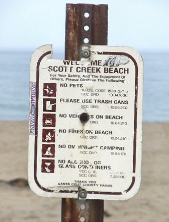
 Typical requests of a beach.
  The other side of the bridge is the marsh area.
Related Links
:Shows sea temperature for Scott Creek area. :Scott Creek Watershed site.
 |
This entry is a seed - a starting point for writing a full entry. You can help the Santa Cruz Wiki by expanding it! Simply click on the "Edit" button. |
Comments
2010-05-10 00:27:07 At Scott Creek, the road signs north of Highway 1 say "No Parking Anytime" and the signs on the beach side (South) say, "No Parking 10PM-6AM." —24.4.231.60


