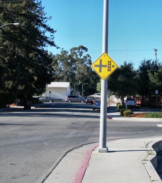
Limekiln Street runs south from Encinal Street to Coral Street. A distance of two blocks. Coral Street changes direction when it meets Limekiln Street. Coral Street turn south from its westward course. Thus, Limekiln Street becomes Coral Street. Prior to 1866 there was a ROAD above Mission Street in Santa Cruz with a similar name. That historic road became High Street. There is no connection between the two roads except by name. Limekiln is one word, but some maps may show it as "Lime Kiln St."
 Limekiln Street viewed from the corner of Fern Street.
Bike-Friendliness
Traffic is minimal, road is level. No bike lanes.
Public Transportation
Bus stop on Coral Street.
Landmarks After Limekiln Street become Coral Street it leads to Evergreen Cemetery.
Major Intersections Encinal Street at Limekiln Street. Coral Street at Limekiln Street.
Restaurants and Shopping
None on Limekiln Street.
Services
The street is mostly known for parking.
Related Pages
- Streets
- Coral Street
- Fern Street
- Encinal Street
- Evergreen Cemetery
- : Google photo of Limekiln Street
 |
This entry is a seed - a starting point for writing a full entry. You can help the Santa Cruz Wiki by expanding it! Simply click on the "Edit" button. |


