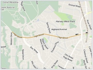
By car, High Street starts at Emmett Street in Mission Plaza. From there it is one way going west for one block to Sylvar Street. HIgh Street continues to Highway 1, where it ends for cars. There is a foot and bicycle bridge that crosses over Highway 1. Across the bridge High Street resumes as a traffic street. One block later at Highland Avenue, High Street becomes a one way going west. When High Street reaches Storey Street --one block going west- High Street continues as a two-way street all the way to where it changes names to Empire Grade, High Street is one of three major roads leading to campus (the other two being Bay Street and Western Drive).
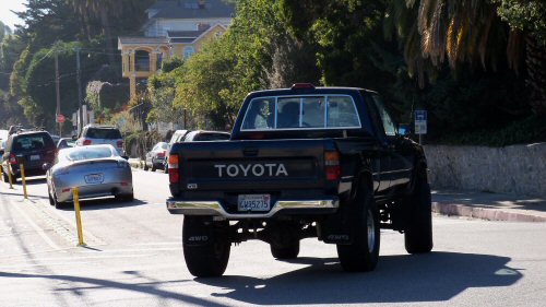
 Lots of traffic turns onto High Street.
Transit
Driving westward on High street usually is low on traffic, but going eastward can be another story entirely. During rush hour, even if High street is the shortest route distance-wise, it is most likely not the fastest. Traffic can be backed up and stopped, leaving you stuck there for 20 minutes or more. Better bets are taking Bay to Mission Street or King Street.
Though the ride westward is uphill, cycling conditions on this street are pretty good. The road was repaved recently, so the ride is almost pothole-free. Plus, it's exhilarating to whiz past all those people stuck in cars on the way back down.
The bus route 10 goes up High street.
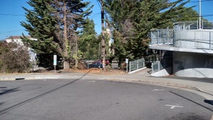
 Up the ramp crosses over Highway 1 to the Mission. Left is a bike/foot trail to Evergreen Street near Harvey West Park.
Businesses
Though there are no businesses on High street (with the exception of those just off High street on Cardiff), the street houses many churches and schools. Some of the churches rent out parking spaces during the weekdays to students.
Churches
 High Street has one way sections.
- First Congregational Church
- High Street Community Church
- Holy Cross Church To get there by car, you must take Mission Street
- Messiah Lutheran Church
- United Church Of Christ
Schools
Community Organizations
Related Links
 |
This entry is a seed - a starting point for writing a full entry. You can help the Santa Cruz Wiki by expanding it! Simply click on the "Edit" button. |


