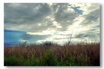
The 59,000-acre area beneath the Yolo Causeway is known as the Yolo Bypass floodway; this floodway is part of the Sacramento River Flood Control Project. The flood control project is a system of levees, dams, bypasses and weirs along the main river channels, and was formally incorporated into a single flood control system in the 1930s by the U.S. Army Corps of Engineers. The primary function of the Yolo Bypass is to protect delta cities from seasonal floods. Water flows into the Yolo Bypass are controlled by the Department of Water Resources. The Yolo Bypass has a maximum water flow capacity of 600,000 cfs. Most of the land in the Bypass is privately owned and managed farmland used to grow a variety of crops during the dry season.
Flooding is the most significant natural hazard in Yolo County, and the Yolo Bypass is an engineered flood basin that receives water from the Sacramento_River, Cache Creek, the Knight's Landing Ridge Cut, Willow Slough, and Putah Creek. During the winter months, weirs in the levee systems along the river and creeks are opened periodically to release water into the floodway to avoid flooding inhabited areas of the counties. To prevent a catastrophic levee failure, the bypass is intented to serve as a diversion channel for the Sacramento River. In fact, the largest cost of managing the Yolo Bypass is the electricity needed to keep the pumps working and the Sacramento River out of the basin!
The big flows feeding the Yolo Bypass tend to come over Fremont Weir — a low, concrete barrier at the north end of the Yolo Bypass in Fremont Weir State Wildlife Area, close to the confluence of the Sacramento and Feather Rivers. It's also at this confluence that the Sutter Bypass dumps water from the Butte Sinks, so essentially the Fremont Weir is handling water from the Sutter Buttes, Sacramento_River, and the Feather River, not to mention the Yuba River and Bear River, which feed into the Feather River. When the water reaches an elevation of 33.5 feet, it goes sliding over the Fremont Weir.
The other major Yolo Bypass feeder is the manually operated Sacramento Weir, just north of West Sacramento on the Sacramento River in the Sacramento Bypass Wildlife Area. Under U.S. Army Corps of Engineers rules, the weir is opened once the Sacramento River hits the 27.5 foot stage at Sacramentos I Street Bridge [Jiboom Street] with continued rising forecasted. The weir consists of 48 steel gates held in place by timber locks; opened by State Department of Water Resources workmen in the pouring rain, these gates allow peak water flows to be diverted down the mile-long Sacramento Bypass in West Sacramento before flowing into the larger Yolo Bypass.
Since its inception, however, the Yolo Bypass has taken on additional roles including agriculture during the summer and fall months and valuable wetland during the flood season, supporting a significant waterfowl population. It is considered a model of a public-private partnership that shows that wildlife, flood control and agriculture can co-exist in a largely urban setting. A 16,000-acre portion of this floodway has been designated the Yolo Bypass Wildlife Area, the largest public/private restoration project west of the Florida Everglades. The bypass is a key component of the habitat restoration planned as part of the CalFed Bay Delta Accord process, and is a vital element of the Central Valley Habitat Joint Venture's habitat restoration goals.
Recent work has shown that the flooded Yolo Bypass also provides excellent habitat for native fish such as Splittail, White Sturgeon and juvenile Chinook Salmon.
 The flooded Yolo Bypass, January 31, 2008.
In 2010, the Yolo Bypass began flooding early in the morning of January 23rd. A short video of the Sacramento River water flowing over the Fremont Weir can be viewed here:
http://www.youtube.com/watch?v=e1JInQwS9ag


